By Aidan Mortensen | KOAL News
Spring officially began on Thursday, bringing a close to a tumultuous winter. Along the Manti Skyline, this change in season has brought much-needed stability to the snow, significantly lowering avalanche danger. Castle Country Radio was joined by Brett Kobernik from the Utah Avalanche Center for this weekend’s avalanche forecast.
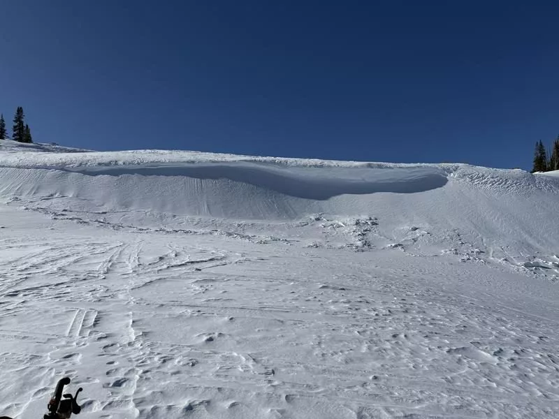
A wild week for the skyline featured mass downpours of snow and a few human-caused avalanches, ” We picked up somewhere in the range of two to two and a half feet of snow over the last week. The most recent storm produced 18 inches in the mid-portion of the skyline Tuesday … There has been a lot of avalanche activity since last week. And not so much natural avalanche activity. This was more human-triggered. And specifically snowmobile-triggered. Numerous snowmobile riders were caught, carried and a couple of them partially buried.”
Despite these events, many recreationists described the conditions midweek as incredible. “On Wednesday, folks found it just to be a glorious day up there for skiing and snowmobiling. I heard numerous people say it was the best day of the winter, hands down.”
Looking ahead to the weekend, Kobernik spoke on what conditions can be expected along the Manti Skyline,” It seems like we’ve got unsettled weather through Saturday and a little bit of wind … I’m anticipating a moderate avalanche danger through the weekend. Perhaps some fresh wind drifts or wind slabs could be sensitive along the upper ridgelines and steep slopes. But for the most part, the danger will decrease through the weekend.”
As has been the story all season long, the persistent weak layer continues to threaten outdoor adventurers. “These layers formed back in November, December and January, and they’re still producing avalanches. The good thing here is that we’ve had just what we needed to help stabilize things. We’ve had consistent snowstorms through March, which helps slowly add weight and compress those layers. It’s like taking fresh powder in your hands, and you can make a snowball with it. You can make those grains bond. So that’s what’s happening slowly, deep down in the snowpack.”
Kobernik provided a tip for those wanting to explore the backcountry to help avoid causing an avalanche:” The most likely places to find an avalanche that breaks into that old snow are going to be more on the north half of the compass. Most of the time, we see these things breaking on north, northeast, and east-facing slopes. So the most simple thing is simply to avoid really steep slopes and upper elevations that face north, northeast and east.”
Closing our conversation, Kobernik said,” As always, check that daily avalanche forecast. That’s probably your best source of information. And it is important to get information before you head out into the backcountry so you know what to expect once you get out there.”
The daily avalanche forecast for the Manti Skyline and ranges across Utah can be found on UtahAvalancheCenter.org.