By Connor Thomas | KPCW | Photo courtesy of Utah Division Of Forestry, Fire & State Lands
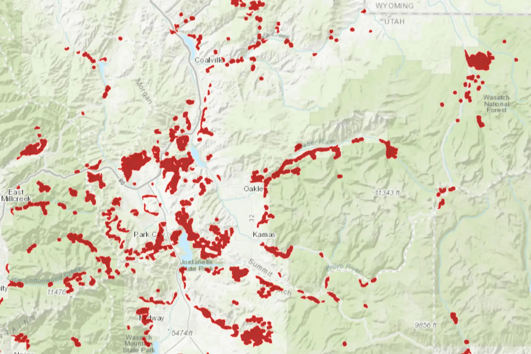
The high-risk wildland-urban interface map released Dec. 18 is a requirement from new state law House Bill 48.
The law, and accompanying fee area, aim to ensure residents are protecting themselves and their neighbors from wildfires.
State Forester Jamie Barnes explained last month HB 48 is a response to Utahns’ rising insurance costs.
“It’s not the entire state that is painted red, and the whole state is not at high risk,” Barnes said at a Nov. 6 meeting in Salt Lake City. “So this is the first step that [legislators] have taken to really try to address the insurance issues in the state.”
HB 48 required the Utah Division of Forestry, Fire & State Lands to identify where development meets wilderness, the area called wildland-urban interface, or WUI.
Read more at KPCW.org.
This article is published through the Utah News Collaborative, a partnership of news organizations in Utah that aims to inform readers across the state.