By Aidan Mortensen | KOAL News
As weather forecasts predict heavy rains impacting the Castle Country and its surrounding areas, the residents of Carbon and Emery County also prepare for what could become historic floods.
According to the National Weather Service office in Salt Lake City, remnants of tropical system Priscilla are expected to move into Utah, impacting primarily the southern and eastern regions of the state. Heavy rains are expected in the areas on Friday, with a cold front moving in on Saturday alongside thunderstorms.
As a result, A flood watch has been issued for a majority of eastern Utah, beginning on Thursday, Oct. 9, at noon and continuing through Sunday, Oct. 12.
⚠️A Flood Watch is in effect for much of central, southern, and eastern Utah beginning Thursday afternoon through Saturday night. An influx of tropical moisture will result in widespread heavy rain across the area, leading to an increased threat of flash flooding. #utwx pic.twitter.com/2MobpwhaWd
— NWS Salt Lake City (@NWSSaltLakeCity) October 8, 2025
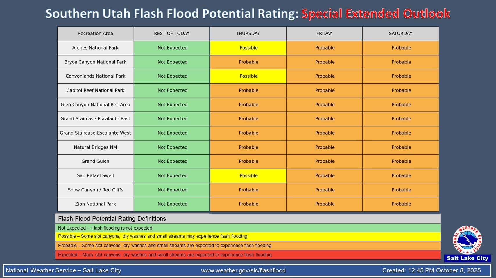
“A special extended outlook was issued for the Southern Utah Flash Flood Potential Rating due to the long duration of this event. Most parks & rec areas are expected to experience flash flooding Thursday into Saturday,” states a social media bulletin from the NWS.
The NWS also encourages those who could be potentially impacted by flooding to check with their insurance provider to ensure proper coverage in the event of property damage.
During floods, the NWS advises against entering floodwaters and recommends staying up to date with current conditions. This can be done online on the NWS website or by listening to a local radio station.
“All of Emery County is forecast to receive a large amount of rain over the next few days. Please stay away from slot canyon areas in the San Rafael Swell, San Rafael Desert and surrounding areas,” reads a social media post from the Emery County Sheriff’s Office.
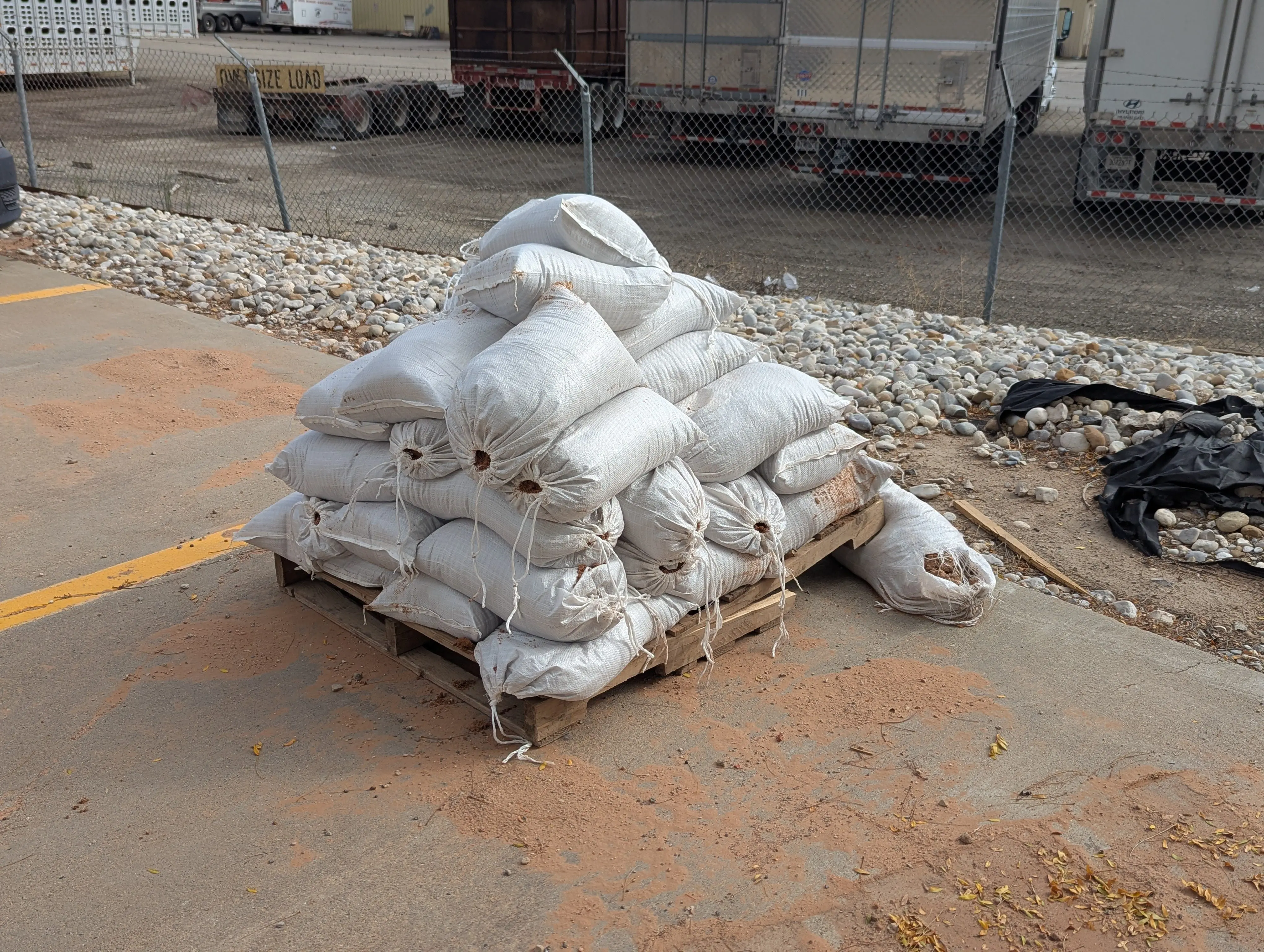
“Within the cities and towns of Emery County, flooding of the streets can be a big problem, especially around storm drains. Stay vigilant and help keep an eye out for clogged drains. If you need sandbags, please contact your city or town office first, and then if more are needed contact the Emery County Sheriff’s Office and make arrangements to pick them up. We have some filled but could run out fast in a large event.”
In addition to the ECSO, the Green River Fire Department also encourages residents to “use caution when accessing backcountry areas, as roads may become impassable due to washouts.”
In Price, volunteers gathered to fill sandbags at the Price City Public Works building to help aid community members in mitigating the impacts of the flood. Bags are available for pickup at the Public Works Building located at 432 West 600 South. The city encourages residents to “Stay safe and take precautions to protect your property.”
East Carbon City is hosting a fill-your-own sandbag station at City Hall.” Please only take what you need so supplies remain available for everyone. If you have any questions, please call City Hall at 435-888-6613,” reads a statement from the city.”
For Helper, Mayor Lenise Peterman announced the availability of sand bags near the Mountain View Cemetery. “Please feel free to go up and bag what you need before this upcoming rain even,” said Peterman. “If you need assistance, please contact City Hall (435-472-5391) and schedule a time to meet parties up there to help you get sandbags as needed.”
For more information and updates on flood conditions, visit the National Weather Service Website here.